Calibration and Validation of Satellite Sensor 2011
I researched on how to calibrate and validate a satellite sensor at CSIR.
I have qualifications and I got an award for being one of the best info provider during presentation. My main objective was to stipulate different challenges that Cal/Val is facing. I was sponsored by the Department of Science and Technology, together with DSTV. Currently studying BSc Hydrogeology in specialization with Geochemistry and Contaminant transport in the vadose zone to the saturated zone.
Take a good at my group's presentation
| Calibration and Validation of Satellite Sensor Presentation |
Nzhelele Formation (Mavhunga) 2011
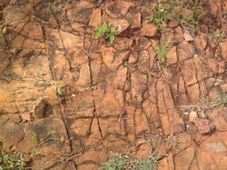
The rock types of Nzhelele Formation (Mavhunga) are predominately sedimentary and metamorphic rocks dominated by one common type of mineral called Quartz. The metamorphic rock type which is common is Quartzite and the sedimentary rock type is Sandstone. All rock types are getting eroded, they appear in a reddish-brown colour which shows oxidation of Iron.
Mountain surface is covered with long tilted beds of Quartzite and Sandstone, which makes it to be around 60-70% rocks and approximately 30-40% soil. All these tilted beds have cracks or joints that might have been caused by collision and grinding of rocks during mass wasting and
they might also have been caused by weathering, mainly hydrolysis and temperature changes.
Residual Dolerite 2011
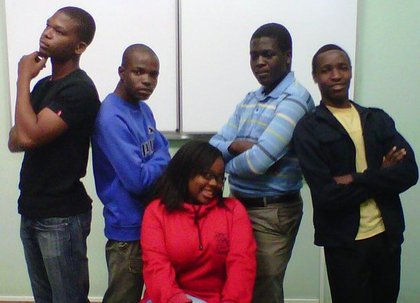
Group 16 on Residual Dolerite presentation.
In the picture
Left: Fred, Thanyani, Mbali at the middle, then Khuliso (Boice) and Chakanya (Elia)
Take a look at our presentation slides below.
In the picture
Left: Fred, Thanyani, Mbali at the middle, then Khuliso (Boice) and Chakanya (Elia)
Take a look at our presentation slides below.
| Residual Dolerite Presentation |
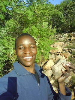
My fellow Geologists 2011
Geologists in the past have been notoriously poor at spreading their message, with fears of 'dumbing down' the science and a use of inappropriate language being just some of the barriers between them and the public. The European Geoparks Network aims to diminish this divide and help bring the delights of learning about the natural landscape to the general public.
Marble Arch Caves European Geopark has over the past two years been active in promoting the awareness of both Geoparks and the geology behind them by organizing a number of outreach activities. The events have not been restricted to any particular age group or social demographic and have been designed with the general public in mind so that everyone can enjoy and understand the landscape of Marble Arch Caves European Geopark.
Some of the most successful events have been family based activities focusing on a variety of aspects of the local geology. These have included family fun days with numerous hand-on activities, treasure hunts and orienteering as well, as guided walks and fossil tours. 'Laidback lectures' and associated guided walks have also proved to be very popular and have acted as insights into more exciting aspects of the local geology as well as investigating how the underlying geology has influenced the local archaeology and history.
By making the local geology more relevant, relaxed and above all else, fun, the gap between geologists and the landscape will we be successful in engaging the public's interest in the world around them.
Reference
http://www.globalgeopark.org/english/ArticlesPublication/Articles/200804/t20080416_755029.htm
Iron Deposits in Africa including the Banded Iron Formation (BIF) 2011
It was a dekstop research done and compiled by Muravha Sedzani Elia, Moswathupa Thabanga and Tshilidzi Lutsinge. Elia's main forcus on the theme was the formation of Iron deposits. After compiling a report we presented on our theme.
| Iron deposits in Africa including the Banded Iron Formatiom Report |
| Iron deposits in Africa including the Banded Iron Formatiom presentation |
Hons Entrance Presentation 2012
Foundation on expansive soils
The presentation was awesome, but i was very nervous.
| Foundation On Expansive Soils Presentation |
| Foundation On Expansive Soils Report |
Engineering geology (GTX 714) Seminar 2012
I had to compile three reports and three presentations.
All my topics were fine, but I liked "Cone Penetration Test" than all other topics.
My presentation was good but not good enough!
All my topics were fine, but I liked "Cone Penetration Test" than all other topics.
My presentation was good but not good enough!
| Cone Penetration Test Report |
| Discuss the perpose of engineering geological mapping and indicate which aspects should appear on an engineering geological map Report |
| Discuss the use of magnetic methods in engineering geological surveys Report |
| GTX 714 Presentation |
Environmental Management and Risk Assessment (GTX 716) Seminar 2012
| Occupational Safety Considerations On Sites Report |
| Occupational Safety Considerations On Sites Presentation |
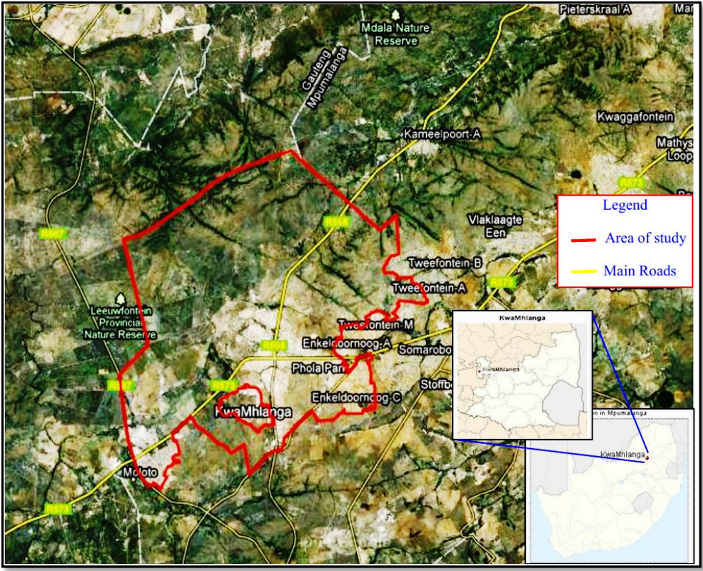
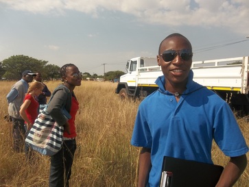
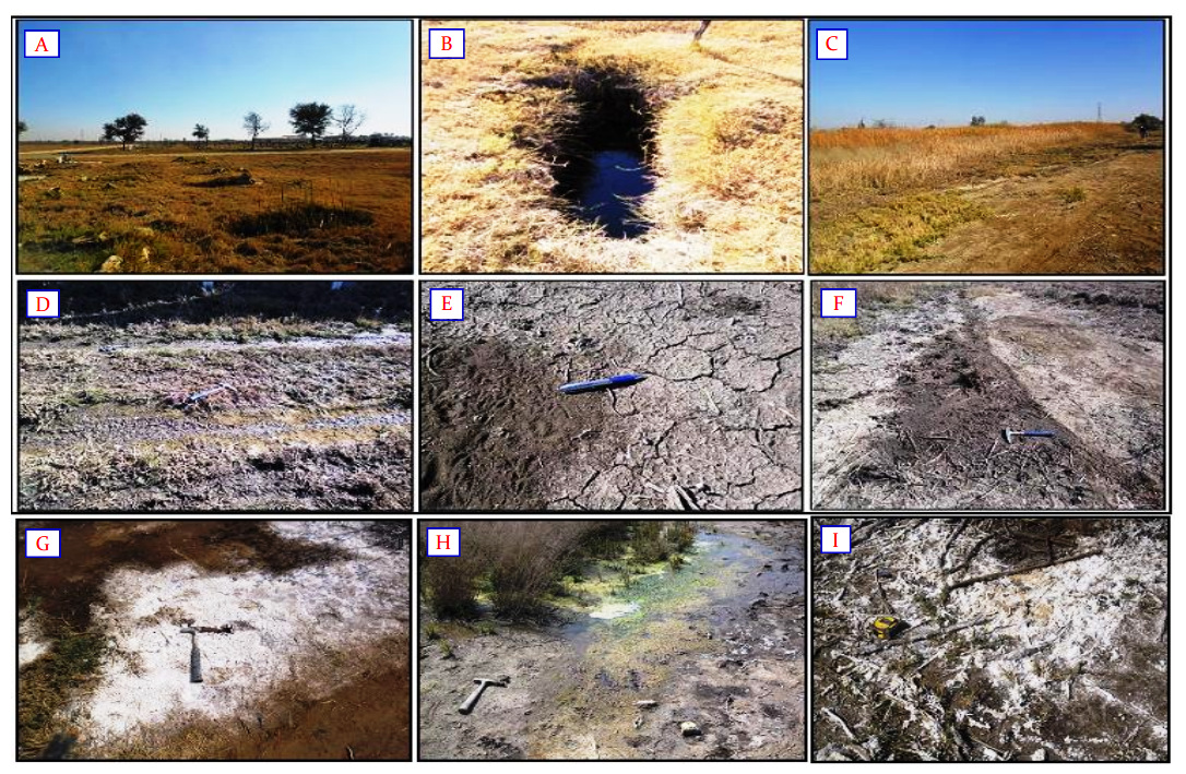
KwaMhlanga Test pits for RDP Houses development (Hons Project) 2012
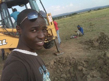
Geotechnical investigations of this project were carried out by an Environmental and Engineering Geology masters student and Hydrogeology honours student from the University of Pretoria as a part of educational project under supervision of Matthys A. Dippenaar. A site is located in KwaMhlanga, Mpumalanga near the R573 road well-known as Moloto road and neighbouring villages are Kameelpoort, Tweefontein, Phola pan, etc. Test pits were excavated in the field and results were recorded from all test pits. Test pit is a hole excavated by hand or mechanical excavator for the purpose of direct and visual inspection of the vertical section of soil and rocks in a profile as a part of site investigation in geotechnical survey (SAICE 2010).
The aim of the project was to provide detailed information and visual field inspection of geotechnical conditions from test pit logs on site for the purpose of Reconstruction and Development Programme (RDP) houses in KwaMhlanga village.
Objectives of the geotechnical investigation of the site include:
· Planning of the investigation
· Collection of available data from published documents.
· Excavation of test pits in the site
· Soil profiling and collecting samples from other test pits
· The data gathered will address the excavatability, material properties and other geotechnical features.
Occurrence of the case study
| Report on Engineering Geological Investigation: Test pit logs in KwaMhlanga for RDP houses development. |
Hydrogeological investigation in Dennilton Agricultural farm 2012
Abstract
The area under investigation is situated on Dennilton Agricultural Holding 242 in Dennilton, number 242 Main Road-northern side of the road, under Elias Motsoaledi Local Municipality in Limpopo. The land is between Boundary Road and Seventh Street with approximated latitude 25°15’25’’ S and longitude 29°08’32” E.
The investigation involved: Drilling a borehole, Grading, Soil classification and Pumping test analysis.
The underlying geology was characterised with highly fractured rocks, with no evidence of any intrusive dykes, corestones and mineral deposits in the vicinity of the site in the maps.
Contaminant Transport and Geochemistry: The Monod equation 2012
| Monod Equation Presentation.pptx |
Recharge with water level and climatic data: GTX 715 Fluid Mechanics 2012
| Recharge with water level and climatic data report |
GTX 719: Use of Eh-pH in groundwater geochemistry 2012
| Use of Eh-pH in groundwater geochemistry report |
| Use of Eh-pH in groundwater geochemistry presentation |
Hydrogeological Modelling 2012
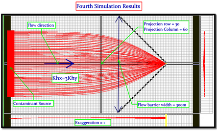
Abstract
This paper will address the change in the transport behaviour of an ideal pollutant plume under a great variation in the degree of anisotropic factor in the model. The first transport behaviour will be modelled under anisotropic factor of 0.333 and the factor will be changed to 2 on the second simulations. An increase in anisotropic factor in the x-direction of the horizontal hydraulic conductivity increases the flow regime in that particular direction and vice versa. Several simulation tries of the funnel-and-gate system will be reported in this paper. Four different funnel simulations were conducted and the minimum width of the funnel-and-gate system that completely redirected all the pollutants to pass through the drain was 300m wide.
This paper will address the change in the transport behaviour of an ideal pollutant plume under a great variation in the degree of anisotropic factor in the model. The first transport behaviour will be modelled under anisotropic factor of 0.333 and the factor will be changed to 2 on the second simulations. An increase in anisotropic factor in the x-direction of the horizontal hydraulic conductivity increases the flow regime in that particular direction and vice versa. Several simulation tries of the funnel-and-gate system will be reported in this paper. Four different funnel simulations were conducted and the minimum width of the funnel-and-gate system that completely redirected all the pollutants to pass through the drain was 300m wide.
| Report on the transport behaviour of an ideal pollutants in the heterogeneous aquifer under different anisotropy factor |
| Presentation on the transport behaviour of an ideal pollutants in the heterogeneous aquifer under different anisotropy factor.pptx |
Impact of cemetery on groundwater pollution 2012
Temba Cemetery overview
Temba Cemetery Hammanskraal
The project is conducted by Elia under the supervision of Matthys. The project involves geotechnical and hydrogeological investigation on three cemeteries in Tshwane. Environmental investigations have been conducted already including the geotech and hydrology. The project thesis will be reviewed by NRF, Council for Geoscience, DWAF and my supervisor. The project involves test pitting, soil sampling, profiling, grading, percolation test, infiltration test, soil analysis in the lab and water sampling.
The project is conducted by Elia under the supervision of Matthys. The project involves geotechnical and hydrogeological investigation on three cemeteries in Tshwane. Environmental investigations have been conducted already including the geotech and hydrology. The project thesis will be reviewed by NRF, Council for Geoscience, DWAF and my supervisor. The project involves test pitting, soil sampling, profiling, grading, percolation test, infiltration test, soil analysis in the lab and water sampling.
